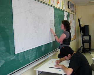
Over the past month Secondary 5 English students have been working on making maps of Waswanipi. As part of their geography class the students were challenged to think visually on a large scale, learn about cartography and spatial drawing, and add their own knowledge of the town to their map. Having a large map provided from the Band Office to work from, students made sketches to plan out their maps. From there they produced their own large scale maps incorporating many shortcuts, trails and land marks that were missing on the government issued map. Here are a couple of pictures of student working as well as some of the finished products.


No comments:
Post a Comment